
Mount Cobb topographic map
Click on the map to display elevation.
About this map
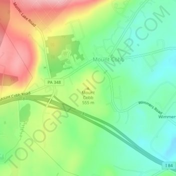
Name: Mount Cobb topographic map, elevation, terrain.
Average elevation: 1,722 ft
Minimum elevation: 1,509 ft
Maximum elevation: 2,051 ft
Lackawanna County trails, hiking, mountain biking, running and outdoor activities
Other topographic maps
Click on a map to view its topography, its elevation and its terrain.
Moosic Lakes
United States > Pennsylvania > Lackawanna County > Jefferson Township
Average elevation: 2,024 ft
Moosic Lakes
United States > Pennsylvania > Lackawanna County > Jefferson Township
Average elevation: 2,018 ft