
Château-Renault topographic map
Interactive map
Click on the map to display elevation.
Château-Renault
Château-Renault is located on the Far-West of the Gâtine Tourangelle plateau, next to the Loir-et-Cher department and at the confluence of two rivers : The Gault and the Brenne. Its Elevation vary between 90 meters and 140 meters on the plateau. The area of the commune is 3.51 square kilometre.
About this map
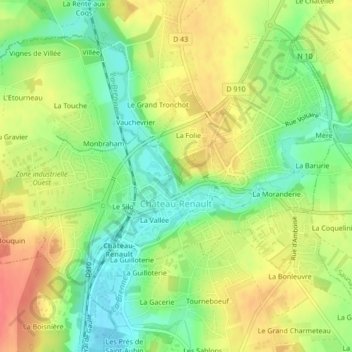
Name: Château-Renault topographic map, elevation, terrain.
Average elevation: 367 ft
Minimum elevation: 272 ft
Maximum elevation: 463 ft