
Thank you for supporting this site ❤️
Make a donation
Make a donation
Gear up for your next adventure:
As an Amazon Associate, this site earns from qualifying purchases at no extra cost to you.
Homorod topographic map
Click on the map to display elevation.
Thank you for supporting this site ❤️
Make a donation
Make a donation
Gear up for your next adventure:
As an Amazon Associate, this site earns from qualifying purchases at no extra cost to you.
About this map
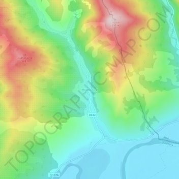
Name: Homorod topographic map, elevation, terrain.
Location: Homorod, Geoagiu, Hunedoara, 335408, Romania (45.92017 23.22727 45.96017 23.26727)
Average elevation: 1,109 ft
Minimum elevation: 650 ft
Maximum elevation: 1,913 ft
Thank you for supporting this site ❤️
Make a donation
Make a donation
Gear up for your next adventure:
As an Amazon Associate, this site earns from qualifying purchases at no extra cost to you.