Geolocate

Insana topographic map

Click on the map to display elevation.

About this map

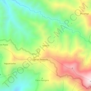
Name: Insana topographic map, elevation, terrain.

Location: Insana, Sozoranga, Loja, 110703, Ecuador (-4.35465 -79.78552 -4.31465 -79.74552)

Average elevation: 5,472 ft

Minimum elevation: 4,085 ft

Maximum elevation: 7,425 ft

Gear up for your next adventure:

🧭Compass with Lanyard - Easy‑carry compass for navigation
🛠️Backpacking Tool Kit - Essential toolkit for outdoor repairs
🩳Quick‑Dry Hiking Shorts - Comfortable and quick‑dry shorts for summer hiking
🌐World Map Poster - Decorative world maps with topographic info
📌Outdoor GPS Map App - Apps and devices for digital topographic navigation

As an Amazon Associate, this site earns from qualifying purchases at no extra cost to you.