Geolocate

Meser topographic map

Click on the map to display elevation.

About this map

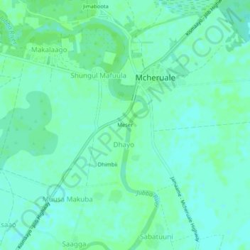
Name: Meser topographic map, elevation, terrain.

Location: Meser, Dhayo, Jamame District, Lower Juba, Jubaland, Somalia (0.22211 42.75489 0.26211 42.79489)

Average elevation: 49 ft

Minimum elevation: 36 ft

Maximum elevation: 59 ft

Gear up for your next adventure:

📚Navigation Handbooks - Master the art of reading topographic maps and using a compass
📡Handheld GPS Device - Reliable handheld GPS for outdoor navigation
📚USA Hiking Guide Books - Top trail guides and map books
🧭Hiking Compass - Precision compass for reliable navigation in the wilderness
🧭Compass with Lanyard - Easy‑carry compass for navigation

As an Amazon Associate, this site earns from qualifying purchases at no extra cost to you.