
Thank you for supporting this site ❤️
Make a donation
Make a donation
Gear up for your next adventure:
As an Amazon Associate, this site earns from qualifying purchases at no extra cost to you.
Megaluh topographic map
Click on the map to display elevation.
Thank you for supporting this site ❤️
Make a donation
Make a donation
Gear up for your next adventure:
As an Amazon Associate, this site earns from qualifying purchases at no extra cost to you.
About this map
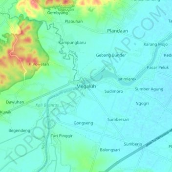
Name: Megaluh topographic map, elevation, terrain.
Location: Megaluh, Jombang, East Java, Java, 61456, Indonesia (-7.53226 112.13023 -7.45226 112.21023)
Average elevation: 141 ft
Minimum elevation: 95 ft
Maximum elevation: 354 ft
Thank you for supporting this site ❤️
Make a donation
Make a donation
Gear up for your next adventure:
As an Amazon Associate, this site earns from qualifying purchases at no extra cost to you.