
Thank you for supporting this site ❤️
Make a donation
Make a donation
Gear up for your next adventure:
As an Amazon Associate, this site earns from qualifying purchases at no extra cost to you.
Bayat topographic map
Click on the map to display elevation.
Thank you for supporting this site ❤️
Make a donation
Make a donation
Gear up for your next adventure:
As an Amazon Associate, this site earns from qualifying purchases at no extra cost to you.
About this map
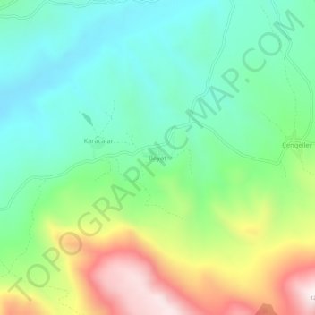
Name: Bayat topographic map, elevation, terrain.
Location: Bayat, Gölpazarı, Bilecik, Marmara Region, Turkey (40.16782 30.24530 40.20782 30.28530)
Average elevation: 2,211 ft
Minimum elevation: 1,339 ft
Maximum elevation: 3,996 ft
Thank you for supporting this site ❤️
Make a donation
Make a donation
Gear up for your next adventure:
As an Amazon Associate, this site earns from qualifying purchases at no extra cost to you.