Geolocate

Montes Subiedes topographic map

Interactive map

Click on the map to display elevation.

About this map

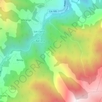
Name: Montes Subiedes topographic map, elevation, terrain.

Location: Montes Subiedes, Camaleño, Liébana, Cantabria, 39582, España (43.12243 -4.71877 43.14243 -4.69877)

Average elevation: 2,812 ft

Minimum elevation: 1,506 ft

Maximum elevation: 4,642 ft

Other topographic maps

Click on a map to view its topography, its elevation and its terrain.

Vallejo

España > Cantabria > Camaleño

Vallejo, Camaleño, Cantabria, 39587, España

Average elevation: 2,999 ft

Fuente Dé

España > Cantabria > Camaleño

Fuente Dé, Camaleño, Cantabria, 39588, España

Average elevation: 4,938 ft

Pico del Buey

España > Cantabria > Camaleño

Pico del Buey, Camaleño, Liébana, Cantabria, 39588, España

Average elevation: 4,797 ft

Tanarrio

España > Cantabria > Camaleño

Tanarrio, Camaleño, Cantabria, 39587, España

Average elevation: 2,657 ft