
Thank you for supporting this site ❤️
Make a donation
Make a donation
Gear up for your next adventure:
As an Amazon Associate, this site earns from qualifying purchases at no extra cost to you.
Lüsch topographic map
Click on the map to display elevation.
Thank you for supporting this site ❤️
Make a donation
Make a donation
Gear up for your next adventure:
As an Amazon Associate, this site earns from qualifying purchases at no extra cost to you.
About this map
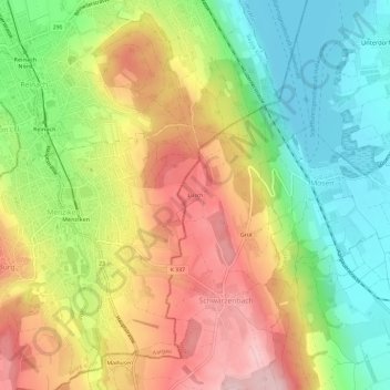
Name: Lüsch topographic map, elevation, terrain.
Location: Lüsch, Schwarzenbach, Beromünster, Luzern, 5737, Schweiz (47.22262 8.18721 47.26262 8.22721)
Average elevation: 1,834 ft
Minimum elevation: 1,453 ft
Maximum elevation: 2,270 ft
Thank you for supporting this site ❤️
Make a donation
Make a donation
Gear up for your next adventure:
As an Amazon Associate, this site earns from qualifying purchases at no extra cost to you.