
Thank you for supporting this site ❤️
Make a donation
Make a donation
Gear up for your next adventure:
As an Amazon Associate, this site earns from qualifying purchases at no extra cost to you.
pirag topographic map
Click on the map to display elevation.
Thank you for supporting this site ❤️
Make a donation
Make a donation
Gear up for your next adventure:
As an Amazon Associate, this site earns from qualifying purchases at no extra cost to you.
About this map
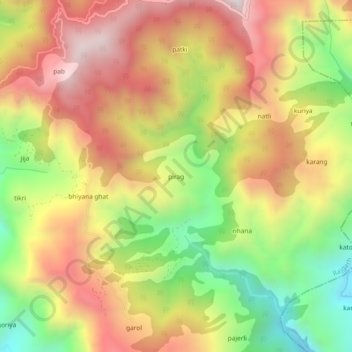
Name: pirag topographic map, elevation, terrain.
Location: pirag, Rajgarh, Sirmaur, Himachal Pradesh, India (30.78356 77.31332 30.82356 77.35332)
Average elevation: 5,299 ft
Minimum elevation: 3,615 ft
Maximum elevation: 6,824 ft
Thank you for supporting this site ❤️
Make a donation
Make a donation
Gear up for your next adventure:
As an Amazon Associate, this site earns from qualifying purchases at no extra cost to you.