
Thank you for supporting this site ❤️
Make a donation
Make a donation
Gear up for your next adventure:
As an Amazon Associate, this site earns from qualifying purchases at no extra cost to you.
Thesoajur topographic map
Click on the map to display elevation.
Thank you for supporting this site ❤️
Make a donation
Make a donation
Gear up for your next adventure:
As an Amazon Associate, this site earns from qualifying purchases at no extra cost to you.
About this map
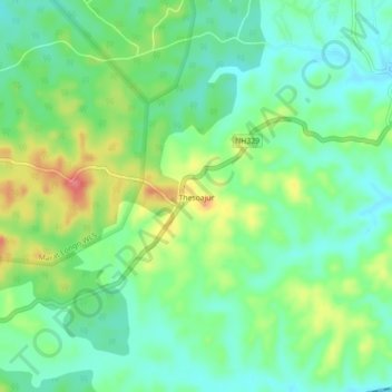
Name: Thesoajur topographic map, elevation, terrain.
Location: Thesoajur, Diphu, Karbi Anglong, Assam, 782460, India (25.80634 93.37774 25.84634 93.41774)
Average elevation: 682 ft
Minimum elevation: 591 ft
Maximum elevation: 853 ft
Thank you for supporting this site ❤️
Make a donation
Make a donation
Gear up for your next adventure:
As an Amazon Associate, this site earns from qualifying purchases at no extra cost to you.