
Thank you for supporting this site ❤️
Make a donation
Make a donation
Gear up for your next adventure:
As an Amazon Associate, this site earns from qualifying purchases at no extra cost to you.
Liberia topographic map
Click on the map to display elevation.
Thank you for supporting this site ❤️
Make a donation
Make a donation
Gear up for your next adventure:
As an Amazon Associate, this site earns from qualifying purchases at no extra cost to you.
About this map
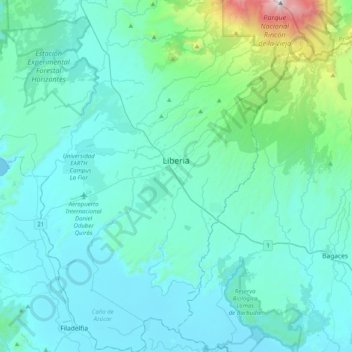
Name: Liberia topographic map, elevation, terrain.
Location: Liberia, Cantón de Liberia, Guanacaste, 50101, Costa Rica (10.41830 -85.58277 10.81273 -85.29202)
Average elevation: 669 ft
Minimum elevation: 0 ft
Maximum elevation: 6,175 ft
Thank you for supporting this site ❤️
Make a donation
Make a donation
Gear up for your next adventure:
As an Amazon Associate, this site earns from qualifying purchases at no extra cost to you.