Geolocate

Unna topographic map

Click on the map to display elevation.

About this map

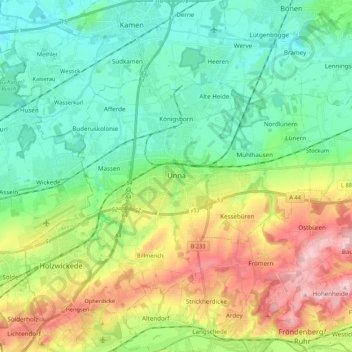
Name: Unna topographic map, elevation, terrain.

Location: Unna, Kreis Unna, North Rhine-Westphalia, Germany (51.49041 7.62875 51.57863 7.84294)

Average elevation: 374 ft

Minimum elevation: 167 ft

Maximum elevation: 801 ft

Gear up for your next adventure:

❄️Traction Cleats - Prevent slips on icy trails during winter hikes
🪑Portable Camp Table - Compact table for campsite meals
🛡️Bear Spray Outdoor - Protection in bear country hikes
🚑Emergency Bivvies - Heat-reflective sleeping bags for survival situations
🥇GPS Hiking Watch - Multi‑sport GPS watch with navigation and trail tracking

As an Amazon Associate, this site earns from qualifying purchases at no extra cost to you.