
Manhattan Island topographic map
Interactive map
Click on the map to display elevation.
About this map
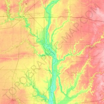
Name: Manhattan Island topographic map, elevation, terrain.
Average elevation: 659 ft
Minimum elevation: 449 ft
Maximum elevation: 873 ft
Other topographic maps
Click on a map to view its topography, its elevation and its terrain.
Glenns Valley
United States of America > Indiana > Indianapolis > Glenns Valley
Glenns Valley, Indianapolis, Marion, Indiana, 46217, United States of America
Average elevation: 692 ft
Brendonwood
United States of America > Indiana > Indianapolis > Brendonwood
Brendonwood, Indianapolis, Marion, Indiana, 46226, United States of America
Average elevation: 814 ft
Fiskville
United States of America > Indiana > Fiskville
Fiskville, Montgomery County, Indiana, 47933, United States of America
Average elevation: 755 ft
Rob Roy
United States of America > Indiana > Rob Roy
Rob Roy, Fountain County, Indiana, United States of America
Average elevation: 646 ft
Chandler
United States of America > Indiana > Chandler
Chandler, Pike County, Indiana, United States of America
Average elevation: 495 ft
Linville
United States of America > Indiana > Linville
Linville, Shelby County, Indiana, 46144, United States of America
Average elevation: 892 ft
Kokomo
United States of America > Indiana > Kokomo
Kokomo, Howard County, Indiana, 46903, United States of America
Average elevation: 827 ft
Blackford County
United States of America > Indiana
Blackford County, Indiana, United States of America
Average elevation: 899 ft
Mount Wells
United States of America > Indiana > Beverly Shores
Mount Wells, Beverly Shores, Porter County, Indiana, 46301, United States of America
Average elevation: 597 ft