
Thank you for supporting this site ❤️
Make a donation
Make a donation
Gear up for your next adventure:
As an Amazon Associate, this site earns from qualifying purchases at no extra cost to you.
Greenbank topographic map
Click on the map to display elevation.
Thank you for supporting this site ❤️
Make a donation
Make a donation
Gear up for your next adventure:
As an Amazon Associate, this site earns from qualifying purchases at no extra cost to you.
About this map
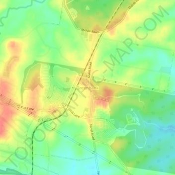
Name: Greenbank topographic map, elevation, terrain.
Location: Greenbank, Logan City, Queensland, 4124, Australia (-27.75178 152.96370 -27.71178 153.00370)
Average elevation: 184 ft
Minimum elevation: 95 ft
Maximum elevation: 279 ft
Thank you for supporting this site ❤️
Make a donation
Make a donation
Gear up for your next adventure:
As an Amazon Associate, this site earns from qualifying purchases at no extra cost to you.