
Thank you for supporting this site ❤️
Make a donation
Make a donation
Gear up for your next adventure:
As an Amazon Associate, this site earns from qualifying purchases at no extra cost to you.
Boudjima topographic map
Click on the map to display elevation.
Thank you for supporting this site ❤️
Make a donation
Make a donation
Gear up for your next adventure:
As an Amazon Associate, this site earns from qualifying purchases at no extra cost to you.
About this map
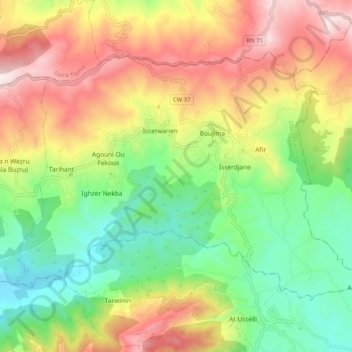
Name: Boudjima topographic map, elevation, terrain.
Location: Boudjima, Daïra de Makouda, Tizi Ouzou, Algérie (36.77533 4.10166 36.83318 4.20379)
Average elevation: 1,385 ft
Minimum elevation: 289 ft
Maximum elevation: 2,828 ft
Thank you for supporting this site ❤️
Make a donation
Make a donation
Gear up for your next adventure:
As an Amazon Associate, this site earns from qualifying purchases at no extra cost to you.