
Thank you for supporting this site ❤️
Make a donation
Make a donation
Gear up for your next adventure:
As an Amazon Associate, this site earns from qualifying purchases at no extra cost to you.
Curaglia topographic map
Click on the map to display elevation.
Thank you for supporting this site ❤️
Make a donation
Make a donation
Gear up for your next adventure:
As an Amazon Associate, this site earns from qualifying purchases at no extra cost to you.
About this map
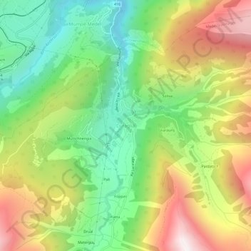
Name: Curaglia topographic map, elevation, terrain.
Location: Curaglia, Medel (Lucmagn), Surselva, Graubünden, 7184, Schweiz (46.65330 8.83678 46.69330 8.87678)
Average elevation: 5,190 ft
Minimum elevation: 3,520 ft
Maximum elevation: 7,428 ft
Thank you for supporting this site ❤️
Make a donation
Make a donation
Gear up for your next adventure:
As an Amazon Associate, this site earns from qualifying purchases at no extra cost to you.