Geolocate

Upi topographic map

Click on the map to display elevation.

About this map

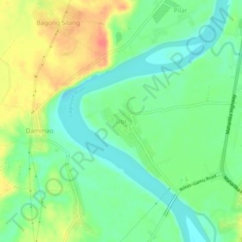
Name: Upi topographic map, elevation, terrain.

Location: Upi, Isabela, Cagayan Valley, 3301, Philippines (17.06230 121.81360 17.10230 121.85360)

Average elevation: 154 ft

Minimum elevation: 79 ft

Maximum elevation: 269 ft

Other topographic maps

Click on a map to view its topography, its elevation and its terrain.

San Guillermo

Philippines > Isabela

Average elevation: 302 ft

Magat Dam

Philippines > Isabela

Average elevation: 577 ft

Gear up for your next adventure:

🍳Camping Cook Set - Complete cookware for outdoor meals
👟Men's Trail Runners - Lightweight footwear for fast-paced exploration and light hiking
🧭Pro Hiking Compasses - High-accuracy liquid-filled compasses for topographic orientation
🩳Quick‑Dry Hiking Shorts - Comfortable and quick‑dry shorts for summer hiking
🪶Survival Guide Book - Expert advice for emergency preparedness

As an Amazon Associate, this site earns from qualifying purchases at no extra cost to you.