
Thank you for supporting this site ❤️
Make a donation
Make a donation
Gear up for your next adventure:
As an Amazon Associate, this site earns from qualifying purchases at no extra cost to you.
Seuzach topographic map
Click on the map to display elevation.
Thank you for supporting this site ❤️
Make a donation
Make a donation
Gear up for your next adventure:
As an Amazon Associate, this site earns from qualifying purchases at no extra cost to you.
About this map
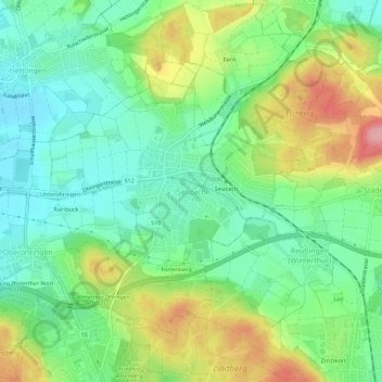
Name: Seuzach topographic map, elevation, terrain.
Location: Seuzach, Bezirk Winterthur, Zurich, 8472, Switzerland (47.52043 8.69835 47.54887 8.75512)
Average elevation: 1,545 ft
Minimum elevation: 1,388 ft
Maximum elevation: 1,827 ft
Thank you for supporting this site ❤️
Make a donation
Make a donation
Gear up for your next adventure:
As an Amazon Associate, this site earns from qualifying purchases at no extra cost to you.