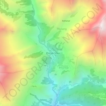
Phortse Tenga topographic map
Interactive map
Click on the map to display elevation.
About this map
Name: Phortse Tenga topographic map, elevation, terrain.
Average elevation: 13,412 ft
Minimum elevation: 10,820 ft
Maximum elevation: 17,008 ft

Click on the map to display elevation.
Name: Phortse Tenga topographic map, elevation, terrain.
Average elevation: 13,412 ft
Minimum elevation: 10,820 ft
Maximum elevation: 17,008 ft