Geolocate

Lich topographic map

Click on the map to display elevation.

About this map

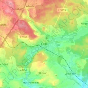
Name: Lich topographic map, elevation, terrain.

Location: Lich, Landkreis Gießen, Hesse, 35423, Germany (50.48017 8.77655 50.56017 8.85655)

Average elevation: 656 ft

Minimum elevation: 479 ft

Maximum elevation: 912 ft

Gear up for your next adventure:

📱Heavy-Duty Phone Cases - Drop-proof and waterproof protection for outdoor navigation
🚗GPS Dash Cams - Record your scenic drives through mountain passes and canyons
🕶️Glacier Sunglasses - Side shields to protect eyes from high-altitude snow glare
🔦Powerful Headlamps - Ultra-bright hands-free lighting for night navigation
🌡️Handheld Weather Meters - Measure wind, temp, and pressure for safe mountain travel

As an Amazon Associate, this site earns from qualifying purchases at no extra cost to you.