

Bayonne topographic map
Click on the map to display elevation.
Bayonne
In the late Quaternary, the current topographic physiognomy was formed—i.e. a set of hills overlooking a swampy lowland. The promontory of Bassussarry–Marracq ultimately extended to the Labourdin foothills. The Grand Bayonne hill is an example. Similarly, on the right bank of the Nive, the heights of Château-Neuf (Mocoron Hill) met the latest advance of the plateau of Saint-Pierre-d'Irube (height 30 to 35 metres (98–115 feet)). On the right bank of the Adour, the heights of Castelnau (today the citadel), with an altitude of 35 to 40 metres (115–131 feet), and Fort (today Saint-Esprit), with an altitude of 20 to 25 metres (66–82 feet), rise above the Barthes of the Adour, the Nive, Bourgneuf, Saint-Frédéric, Sainte-Croix, Aritxague, and Pontots.
About this map
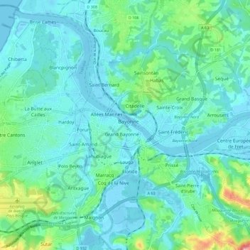
Name: Bayonne topographic map, elevation, terrain.
Average elevation: 75 ft
Minimum elevation: -13 ft
Maximum elevation: 433 ft