Geolocate

Numero topographic map

Click on the map to display elevation.

About this map

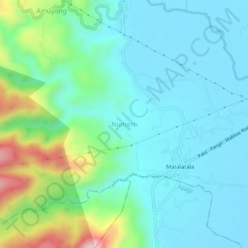
Name: Numero topographic map, elevation, terrain.

Location: Numero, Mabitac, Laguna, Calabarzon, 4020, Philippines (14.40322 121.38033 14.44322 121.42033)

Average elevation: 295 ft

Minimum elevation: 3 ft

Maximum elevation: 1,325 ft

Gear up for your next adventure:

🧤Hiking Gloves - Protective gloves for rugged trails
🎒Outdoor Daypacks - Lightweight backpacks designed for carrying maps and essential gear
🪶Fire Starter Kit - Reliable fire starter for survival and camping
🔌USB Car Charger - Car charger for on‑the‑go power needs
🌡️Portable Weather Meter - Track weather conditions on the trail

As an Amazon Associate, this site earns from qualifying purchases at no extra cost to you.