
Thank you for supporting this site ❤️
Make a donation
Make a donation
Gear up for your next adventure:
As an Amazon Associate, this site earns from qualifying purchases at no extra cost to you.
Panadtalan topographic map
Click on the map to display elevation.
Thank you for supporting this site ❤️
Make a donation
Make a donation
Gear up for your next adventure:
As an Amazon Associate, this site earns from qualifying purchases at no extra cost to you.
About this map
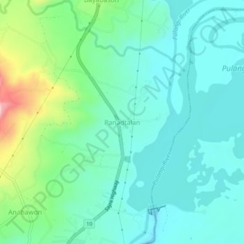
Name: Panadtalan topographic map, elevation, terrain.
Location: Panadtalan, Bukidnon, Northern Mindanao, 08714, Philippines (7.78055 124.99926 7.82055 125.03926)
Average elevation: 1,079 ft
Minimum elevation: 860 ft
Maximum elevation: 1,821 ft
Thank you for supporting this site ❤️
Make a donation
Make a donation
Gear up for your next adventure:
As an Amazon Associate, this site earns from qualifying purchases at no extra cost to you.