Geolocate

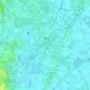
Bagumbayan topographic map

Click on the map to display elevation.

About this map
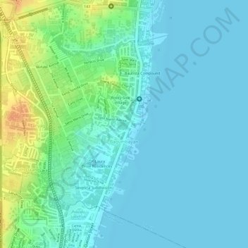
Name: Bagumbayan topographic map, elevation, terrain.

Location: Bagumbayan, Taguig District 1, Taguig, Southern Manila District, Metro Manila, Philippines (14.46596 121.04758 14.48614 121.06423)

Average elevation: 39 ft

Minimum elevation: 3 ft

Maximum elevation: 135 ft

Other topographic maps

Click on a map to view its topography, its elevation and its terrain.
Taguig River

Philippines > Taguig

Average elevation: 16 ft

De Jesus Oval

Philippines > Taguig

Average elevation: 82 ft

Taguig River

Philippines > Taguig

Average elevation: 20 ft

BGC Greenway Park

Philippines > Taguig

Average elevation: 82 ft

Tipas River

Philippines > Taguig

Average elevation: 13 ft

Taguig River

Philippines > Taguig

Average elevation: 10 ft

Daang Manunuso Creek

Philippines > Taguig

Average elevation: 16 ft

Gear up for your next adventure:

🩹Survival Bandages - High‑quality bandages for emergencies
🧦Hiking Socks - Comfortable socks to prevent blisters on long hikes
📷Action Cameras - Rugged cameras to document your journeys across rugged terrain
🔋Solar Power Banks - Keep your GPS and phone charged in remote wilderness areas
🧣Hiking Neck Gaiter - Multi‑use neck protection for outdoor weather

As an Amazon Associate, this site earns from qualifying purchases at no extra cost to you.