
Ouled Abbou topographic map
Interactive map
Click on the map to display elevation.
About this map
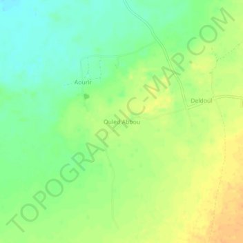
Name: Ouled Abbou topographic map, elevation, terrain.
Location: Ouled Abbou, Deldoul, Daïra Aougrout, Timimoune, Algérie (28.74658 0.01713 28.78658 0.05713)
Average elevation: 827 ft
Minimum elevation: 771 ft
Maximum elevation: 879 ft
Other topographic maps
Click on a map to view its topography, its elevation and its terrain.
Aougrout
Algérie > Timimoune > Daïra Aougrout > Aougrout
Aougrout, Daïra Aougrout, Timimoune, 1012, Algérie
Average elevation: 1,112 ft
Metarfa
Algérie > Timimoune > Daïra Aougrout > Metarfa
Metarfa, Daïra Aougrout, Timimoune, Algérie
Average elevation: 863 ft