Geolocate

El Chaco topographic map

Click on the map to display elevation.

About this map

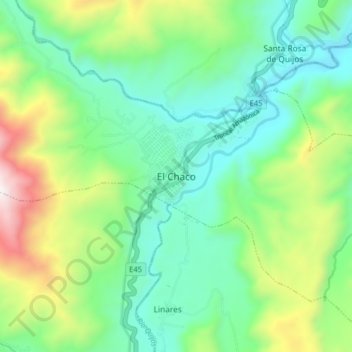
Name: El Chaco topographic map, elevation, terrain.

Location: El Chaco, Cantón El Chaco, Napo, Ecuador (-0.37866 -77.84985 -0.29866 -77.76985)

Average elevation: 5,850 ft

Minimum elevation: 4,610 ft

Maximum elevation: 8,835 ft

Gear up for your next adventure:

🔭Compact Binoculars - HD vision for scouting terrain and identifying distant landmarks
🧣Hiking Neck Gaiter - Multi‑use neck protection for outdoor weather
📱Heavy-Duty Phone Cases - Drop-proof and waterproof protection for outdoor navigation
🗺️Topographic Maps - Detailed topo maps for hiking, exploring and outdoor navigation
🧯Portable Fire Pit - Compact fire pit for camping spots

As an Amazon Associate, this site earns from qualifying purchases at no extra cost to you.