
Duncan Bay topographic map
Click on the map to display elevation.
About this map
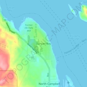
Name: Duncan Bay topographic map, elevation, terrain.
Average elevation: 62 ft
Minimum elevation: -7 ft
Maximum elevation: 344 ft
Other topographic maps
Click on a map to view its topography, its elevation and its terrain.
John Hart Dam
Canada > British Columbia > Strathcona Regional District > Campbell River
Average elevation: 509 ft
Elk Falls Provincial Park
Canada > British Columbia > Strathcona Regional District > Campbell River
Average elevation: 315 ft
John Hart Lake
Canada > British Columbia > Strathcona Regional District > Campbell River
Average elevation: 528 ft