
Gwebi topographic map
Interactive map
Click on the map to display elevation.
About this map
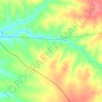
Name: Gwebi topographic map, elevation, terrain.
Location: Gwebi, Zvimba, Mashonaland West, Zimbabwe (-17.60976 30.64335 -17.56504 30.75912)
Average elevation: 4,642 ft
Minimum elevation: 4,518 ft
Maximum elevation: 4,780 ft
Other topographic maps
Click on a map to view its topography, its elevation and its terrain.
Nyabira
Zimbabwe > Mashonaland West > Zvimba > Nyabira
Nyabira, Zvimba, Mashonaland West, Zimbabwe
Average elevation: 4,688 ft