
Thank you for supporting this site ❤️
Make a donation
Make a donation
Gear up for your next adventure:
As an Amazon Associate, this site earns from qualifying purchases at no extra cost to you.
Wavre topographic map
Click on the map to display elevation.
Thank you for supporting this site ❤️
Make a donation
Make a donation
Gear up for your next adventure:
As an Amazon Associate, this site earns from qualifying purchases at no extra cost to you.
About this map
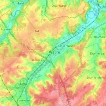
Name: Wavre topographic map, elevation, terrain.
Location: Wavre, Nivelles, Walloon Brabant, Wallonia, 1300, Belgium (50.67624 4.56845 50.75624 4.64845)
Average elevation: 272 ft
Minimum elevation: 98 ft
Maximum elevation: 463 ft
Thank you for supporting this site ❤️
Make a donation
Make a donation
Gear up for your next adventure:
As an Amazon Associate, this site earns from qualifying purchases at no extra cost to you.