Geolocate

Chandi topographic map

Click on the map to display elevation.

About this map

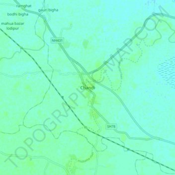
Name: Chandi topographic map, elevation, terrain.

Location: Chandi, Nalanda, Bihar, 803108, India (25.28601 85.36327 25.36601 85.44327)

Average elevation: 161 ft

Minimum elevation: 151 ft

Maximum elevation: 177 ft

Gear up for your next adventure:

🧥Men's Rain Shells - Premium waterproof and breathable jackets for mountain weather
🧥Waterproof Jacket for Hiking - Breathable and rugged rain jacket for outdoor excursions
🧯Emergency Survival Kit - All‑in‑one survival essentials for the backcountry
💧Water Purification System - Clean water on the trail with reliable purifiers
🪄Magnetic Compass - Accurate compass for navigation

As an Amazon Associate, this site earns from qualifying purchases at no extra cost to you.