
Thank you for supporting this site ❤️
Make a donation
Make a donation
Gear up for your next adventure:
As an Amazon Associate, this site earns from qualifying purchases at no extra cost to you.
Bodhan topographic map
Click on the map to display elevation.
Thank you for supporting this site ❤️
Make a donation
Make a donation
Gear up for your next adventure:
As an Amazon Associate, this site earns from qualifying purchases at no extra cost to you.
About this map
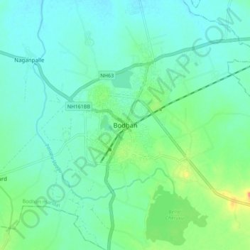
Name: Bodhan topographic map, elevation, terrain.
Location: Bodhan, Bodhan mandal, Nizamabad, Telangana, 503185, India (18.61369 77.85368 18.69369 77.93368)
Average elevation: 1,198 ft
Minimum elevation: 1,152 ft
Maximum elevation: 1,355 ft
Thank you for supporting this site ❤️
Make a donation
Make a donation
Gear up for your next adventure:
As an Amazon Associate, this site earns from qualifying purchases at no extra cost to you.