Geolocate

Rednitzhembach topographic map

Click on the map to display elevation.

About this map

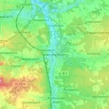
Name: Rednitzhembach topographic map, elevation, terrain.

Location: Rednitzhembach, Landkreis Roth, Bayern, 91186, Deutschland (49.26149 11.03830 49.34149 11.11830)

Average elevation: 1,148 ft

Minimum elevation: 1,014 ft

Maximum elevation: 1,430 ft

Gear up for your next adventure:

🔦Compact Flashlight - Reliable flashlight for emergencies
☀️Outdoor Sunscreen - High protection sunscreen for outdoor activities
🧭Outdoor Navigation Book - Learn advanced navigation skills
🧭GPS Watch Accessories - Bands and chargers for GPS watches
😴Insulated Sleeping Pads - Compact and warm pads for high-elevation camping

As an Amazon Associate, this site earns from qualifying purchases at no extra cost to you.