
Make a donation
Gear up for your next adventure:
As an Amazon Associate, this site earns from qualifying purchases at no extra cost to you.
Matoury topographic map
Click on the map to display elevation.
Make a donation
Gear up for your next adventure:
As an Amazon Associate, this site earns from qualifying purchases at no extra cost to you.
Matoury
La commune se situe en Guyane française sur le continent de l'Amérique du sud. L'altitude maximale de la commune est de 234 mètres en raison de la présence du Mont Grand Matoury. Au nord, la commune dispose d'une zone côtière bordée par l'océan Atlantique ; un port y est aménagé.
Make a donation
Gear up for your next adventure:
As an Amazon Associate, this site earns from qualifying purchases at no extra cost to you.
About this map
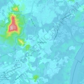
Name: Matoury topographic map, elevation, terrain.
Location: Matoury, Arrondissement de Cayenne, Guyane, 97351, France (4.80967 -52.36687 4.88967 -52.28687)
Average elevation: 49 ft
Minimum elevation: -3 ft
Maximum elevation: 758 ft
Make a donation
Gear up for your next adventure:
As an Amazon Associate, this site earns from qualifying purchases at no extra cost to you.