Geolocate

Rhea topographic map

Click on the map to display elevation.

About this map

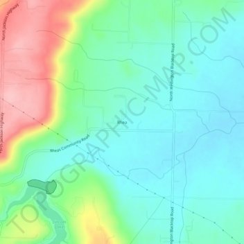
Name: Rhea topographic map, elevation, terrain.

Location: Rhea, Washington County, Arkansas, United States (35.99425 -94.42299 36.03425 -94.38299)

Average elevation: 1,230 ft

Minimum elevation: 1,083 ft

Maximum elevation: 1,591 ft

Washington County trails, hiking, mountain biking, running and outdoor activities

Gear up for your next adventure:

🔋Rechargeable Batteries - Power up your outdoor devices
🌡️Handheld Weather Meters - Measure wind, temp, and pressure for safe mountain travel
🧭Map Reading Tools - Tools and kits for map navigation
👖Convertible Hiking Pants - Versatile zip-off pants for changing altitudes and temperatures
🏫Relief Map Kits - Hands-on tools for teaching landforms and elevation

As an Amazon Associate, this site earns from qualifying purchases at no extra cost to you.