
Thank you for supporting this site ❤️
Make a donation
Make a donation
Gear up for your next adventure:
As an Amazon Associate, this site earns from qualifying purchases at no extra cost to you.
Ried im Innkreis topographic map
Click on the map to display elevation.
Thank you for supporting this site ❤️
Make a donation
Make a donation
Gear up for your next adventure:
As an Amazon Associate, this site earns from qualifying purchases at no extra cost to you.
About this map
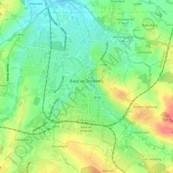
Name: Ried im Innkreis topographic map, elevation, terrain.
Location: Ried im Innkreis, Bezirk Ried, Upper Austria, 4910, Austria (48.19098 13.46323 48.22410 13.50610)
Average elevation: 1,467 ft
Minimum elevation: 1,371 ft
Maximum elevation: 1,608 ft
Thank you for supporting this site ❤️
Make a donation
Make a donation
Gear up for your next adventure:
As an Amazon Associate, this site earns from qualifying purchases at no extra cost to you.