Geolocate

Clavering topographic map

Click on the map to display elevation.

About this map

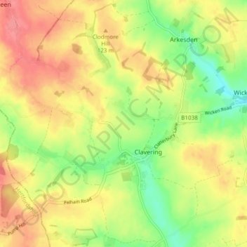
Name: Clavering topographic map, elevation, terrain.

Location: Clavering, Uttlesford, Essex, England, United Kingdom (51.95036 0.09989 51.99518 0.17443)

Average elevation: 354 ft

Minimum elevation: 236 ft

Maximum elevation: 459 ft

Gear up for your next adventure:

🩳Quick‑Dry Hiking Shorts - Comfortable and quick‑dry shorts for summer hiking
🚗GPS Dash Cams - Record your scenic drives through mountain passes and canyons
Backpacking Tents - Weight-optimized shelters for multi-day topographic surveys
🪑Ultralight Camp Chairs - Portable seating for resting after a long day of mapping
🔋Rechargeable Batteries - Power up your outdoor devices

As an Amazon Associate, this site earns from qualifying purchases at no extra cost to you.