Geolocate

Cushcanday topographic map

Click on the map to display elevation.

About this map

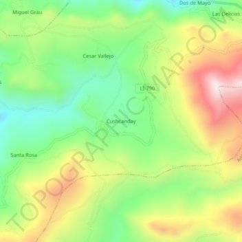
Name: Cushcanday topographic map, elevation, terrain.

Location: Cushcanday, Usquil, Otuzco, La Libertad, Perú (-7.89185 -78.45399 -7.85185 -78.41399)

Average elevation: 11,608 ft

Minimum elevation: 10,699 ft

Maximum elevation: 12,844 ft

Gear up for your next adventure:

🛡️Insect Repellent - Protection against bugs during outdoor activities
🛰️Satellite Messengers - Emergency SOS and two-way messaging for off-grid adventures
🧤Hiking Gloves - Protective gloves for rugged trails
🗺️Topographic Maps - Detailed topo maps for hiking, exploring and outdoor navigation
🎒Outdoor Daypacks - Lightweight backpacks designed for carrying maps and essential gear

As an Amazon Associate, this site earns from qualifying purchases at no extra cost to you.