
Thank you for supporting this site ❤️
Make a donation
Make a donation
Gear up for your next adventure:
As an Amazon Associate, this site earns from qualifying purchases at no extra cost to you.
Alger topographic map
Click on the map to display elevation.
Thank you for supporting this site ❤️
Make a donation
Make a donation
Gear up for your next adventure:
As an Amazon Associate, this site earns from qualifying purchases at no extra cost to you.
About this map
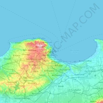
Name: Alger topographic map, elevation, terrain.
Location: Alger, Daïra Sidi M'Hamed, Alger, 16007, RADP (36.61535 2.90007 36.93535 3.22007)
Average elevation: 148 ft
Minimum elevation: -7 ft
Maximum elevation: 1,302 ft
Thank you for supporting this site ❤️
Make a donation
Make a donation
Gear up for your next adventure:
As an Amazon Associate, this site earns from qualifying purchases at no extra cost to you.