Geolocate

Maroochy River topographic map

Click on the map to display elevation.

About this map

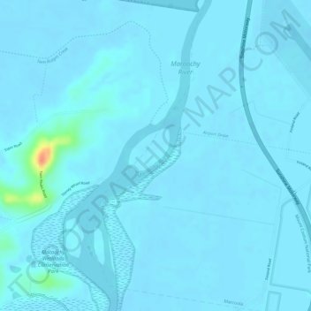
Name: Maroochy River topographic map, elevation, terrain.

Location: Maroochy River, Maroochydore, Queensland, 4564, Australia (-26.59752 153.05668 -26.59156 153.06350)

Average elevation: 10 ft

Minimum elevation: -7 ft

Maximum elevation: 164 ft

Other topographic maps

Click on a map to view its topography, its elevation and its terrain.

Maroochydore

Australia > Queensland > Maroochydore

Average elevation: 66 ft

Mount Coolum

Australia > Queensland > Maroochydore

Average elevation: 52 ft

Palmview

Australia > Queensland > Maroochydore

Average elevation: 33 ft

Tinbeerwah

Australia > Queensland > Maroochydore

Average elevation: 354 ft

Witta

Australia > Queensland > Maroochydore

Average elevation: 1,375 ft

Gear up for your next adventure:

🔭Stargazing Telescopes - Perfect for camping in low-light pollution areas shown on maps
🩹Survival Bandages - High‑quality bandages for emergencies
🛌Ultralight Sleeping Bags - Compact down bags for cold nights in the wilderness
🎒Hydration Pack - Hands‑free water reservoir for long hikes
🪶Multi‑Purpose Knife - Useful blade for camp and trail

As an Amazon Associate, this site earns from qualifying purchases at no extra cost to you.