
Thank you for supporting this site ❤️
Make a donation
Make a donation
Gear up for your next adventure:
As an Amazon Associate, this site earns from qualifying purchases at no extra cost to you.
Islantilla topographic map
Click on the map to display elevation.
Thank you for supporting this site ❤️
Make a donation
Make a donation
Gear up for your next adventure:
As an Amazon Associate, this site earns from qualifying purchases at no extra cost to you.
About this map
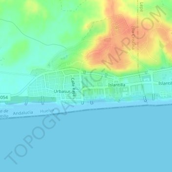
Name: Islantilla topographic map, elevation, terrain.
Location: Islantilla, Costa Occidental, Huelva, Andalucía, España (37.20383 -7.25438 37.20907 -7.23093)
Average elevation: 36 ft
Minimum elevation: -7 ft
Maximum elevation: 141 ft
Thank you for supporting this site ❤️
Make a donation
Make a donation
Gear up for your next adventure:
As an Amazon Associate, this site earns from qualifying purchases at no extra cost to you.