
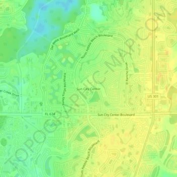
Sun City Center topographic map
Interactive map
Click on the map to display elevation.
About this map
Name: Sun City Center topographic map, elevation, terrain.
Average elevation: 56 ft
Minimum elevation: 10 ft
Maximum elevation: 82 ft
Hillsborough County trails, hiking, mountain biking, running and outdoor activities
Other topographic maps
Click on a map to view its topography, its elevation and its terrain.
Lutz
United States > Florida > Hillsborough County > Tampa
Lutz is characterized by a gently rolling topography that showcases the distinctive features of the central Florida landscape. The area has an average elevation of about 70 feet (21 meters) above sea level, contributing to its mild undulations rather than dramatic elevation changes. The terrain is marked by a…
Average elevation: 66 ft
City of Tampa Waterworks Dam
United States > Florida > Hillsborough County > Tampa > Altos Verdes
Average elevation: 43 ft
Alafia Scrub Nature Preserve
United States > Florida > Hillsborough County > Riverview
Average elevation: 33 ft
Dover
United States > Florida > Hillsborough County > Brandon > Aarons Place
Average elevation: 108 ft
Egypt Lake-Leto
United States > Florida > Hillsborough County
Egypt Lake-Leto is located in northwestern Hillsborough County at 28°0′55″N 82°30′26″W / 28.01528°N 82.50722°W / 28.01528; -82.50722 (28.015396, -82.507311), 7 miles (11 km) northwest of downtown Tampa. The elevation for the CDP is 45 feet (14 m) above sea level.
Average elevation: 49 ft