Geolocate

Nagano topographic map

Click on the map to display elevation.

About this map

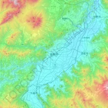
Name: Nagano topographic map, elevation, terrain.

Location: Nagano, Nagano Prefecture, Chubu Region, 380-8512, Japan (36.48859 138.03477 36.80859 138.35477)

Average elevation: 2,497 ft

Minimum elevation: 1,024 ft

Maximum elevation: 7,615 ft

Gear up for your next adventure:

Solar GPS Watches - Advanced multisport watches with built-in topographic maps
🚁Photography Drones - Capture stunning aerial views of landforms and topography
🪓Survival Multi‑Tool - Versatile tool for camp and trail tasks
🎒Outdoor Daypacks - Lightweight backpacks designed for carrying maps and essential gear
📖Nature Tracking Books - Learn to track wildlife and terrain

As an Amazon Associate, this site earns from qualifying purchases at no extra cost to you.