Geolocate

Nowendoc topographic map

Click on the map to display elevation.

About this map

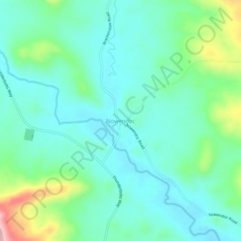
Name: Nowendoc topographic map, elevation, terrain.

Location: Nowendoc, Walcha Council, New South Wales, Australia (-31.53337 151.69713 -31.49337 151.73713)

Average elevation: 2,884 ft

Minimum elevation: 2,736 ft

Maximum elevation: 3,356 ft

Other topographic maps

Click on a map to view its topography, its elevation and its terrain.

Tuggolo Creek

Australia > New South Wales > Nowendoc

Average elevation: 1,893 ft

Gear up for your next adventure:

📻Weather Alert Radios - Stay informed of storm risks while off-the-grid
🪶Paracord Bracelet - Survival bracelet with built‑in tools
🦺Reflective Outdoor Gear - Safety gear for low‑light conditions
🧢Outdoor Hiking Hat - Sun protection hat for outdoor explorers
📖Nature Tracking Books - Learn to track wildlife and terrain

As an Amazon Associate, this site earns from qualifying purchases at no extra cost to you.