
Thank you for supporting this site ❤️
Make a donation
Make a donation
Gear up for your next adventure:
As an Amazon Associate, this site earns from qualifying purchases at no extra cost to you.
Tlatzala topographic map
Click on the map to display elevation.
Thank you for supporting this site ❤️
Make a donation
Make a donation
Gear up for your next adventure:
As an Amazon Associate, this site earns from qualifying purchases at no extra cost to you.
About this map
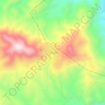
Name: Tlatzala topographic map, elevation, terrain.
Location: Tlatzala, Tlapa de Comonfort, Guerrero, México (17.59516 -98.57013 17.63516 -98.53013)
Average elevation: 4,675 ft
Minimum elevation: 3,481 ft
Maximum elevation: 6,017 ft
Thank you for supporting this site ❤️
Make a donation
Make a donation
Gear up for your next adventure:
As an Amazon Associate, this site earns from qualifying purchases at no extra cost to you.