
Make a donation
Gear up for your next adventure:
As an Amazon Associate, this site earns from qualifying purchases at no extra cost to you.
Heringhausen topographic map
Click on the map to display elevation.
Make a donation
Gear up for your next adventure:
As an Amazon Associate, this site earns from qualifying purchases at no extra cost to you.
About this map
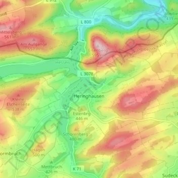
Name: Heringhausen topographic map, elevation, terrain.
Average elevation: 1,460 ft
Minimum elevation: 1,056 ft
Maximum elevation: 1,916 ft
Make a donation
Gear up for your next adventure:
As an Amazon Associate, this site earns from qualifying purchases at no extra cost to you.
Other topographic maps
Click on a map to view its topography, its elevation and its terrain.
Burg Hessenstein
Deutschland > Hessen > Landkreis Waldeck-Frankenberg > Ederbringhausen
Die Höhenburg befindet sich in einsamer Waldlage etwa 1,7 km südöstlich von Ederbringhausen auf einem etwa 327 m hohen, südlichen Bergsporn des Kesebergs (431,2 m), auf dessen nördlichem Ausläufer die Ruine Keseburg liegt. Südlich umfließt der Lengelbach Berg und Burg und mündet etwa 500 m westlich…
Average elevation: 1,142 ft
Make a donation
Gear up for your next adventure:
As an Amazon Associate, this site earns from qualifying purchases at no extra cost to you.
Ettelsberg
Deutschland > Hessen > Landkreis Waldeck-Frankenberg > Willingen
Average elevation: 2,352 ft