
Thank you for supporting this site ❤️
Make a donation
Make a donation
Gear up for your next adventure:
As an Amazon Associate, this site earns from qualifying purchases at no extra cost to you.
Aschheim topographic map
Click on the map to display elevation.
Thank you for supporting this site ❤️
Make a donation
Make a donation
Gear up for your next adventure:
As an Amazon Associate, this site earns from qualifying purchases at no extra cost to you.
About this map
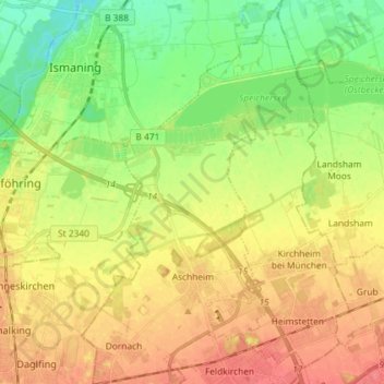
Name: Aschheim topographic map, elevation, terrain.
Location: Aschheim, Landkreis München, Bavaria, 85609, Germany (48.14429 11.67393 48.24110 11.75571)
Average elevation: 1,654 ft
Minimum elevation: 1,558 ft
Maximum elevation: 1,745 ft
Thank you for supporting this site ❤️
Make a donation
Make a donation
Gear up for your next adventure:
As an Amazon Associate, this site earns from qualifying purchases at no extra cost to you.