Geolocate

Torrel topographic map

Click on the map to display elevation.

About this map

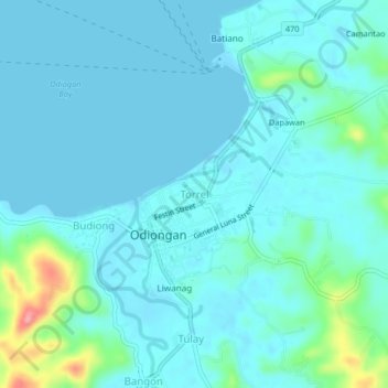
Name: Torrel topographic map, elevation, terrain.

Location: Torrel, Odiongan, Romblon, Mimaropa, 5505, Philippines (12.38394 121.96579 12.42394 122.00579)

Average elevation: 49 ft

Minimum elevation: -3 ft

Maximum elevation: 331 ft

Gear up for your next adventure:

GPS Sports Watch - GPS watch for running, hiking and training
🦶Carbon Trekking Poles - Reduce knee impact on steep descents with ultra-light poles
🎒Trail Energy Bars - High‑calorie bars for hiking energy
🪶Survival Guide Book - Expert advice for emergency preparedness
🛡️Insect Repellent - Protection against bugs during outdoor activities

As an Amazon Associate, this site earns from qualifying purchases at no extra cost to you.