Geolocate

Cogunan topographic map

Click on the map to display elevation.

About this map

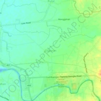
Name: Cogunan topographic map, elevation, terrain.

Location: Cogunan, Nasugbu, Batangas, Calabarzon, Philippines (14.04252 120.63903 14.08252 120.67903)

Average elevation: 43 ft

Minimum elevation: -3 ft

Maximum elevation: 105 ft

Other topographic maps

Click on a map to view its topography, its elevation and its terrain.

Talamitam

Philippines > Batangas > Nasugbu > Kayrilaw

Average elevation: 1,076 ft

Gear up for your next adventure:

🦶Hiking Gaiters - Keep debris and water out of your boots
🧦Merino Wool Socks - Moisture-wicking, blister-preventing socks for long treks
🛰️Satellite Messengers - Emergency SOS and two-way messaging for off-grid adventures
🪄Magnetic Compass - Accurate compass for navigation
🧤Tactile Hiking Gloves - Keep hands warm while operating GPS and smartphone screens

As an Amazon Associate, this site earns from qualifying purchases at no extra cost to you.