
Thank you for supporting this site ❤️
Make a donation
Make a donation
Gear up for your next adventure:
As an Amazon Associate, this site earns from qualifying purchases at no extra cost to you.
Domodossola topographic map
Click on the map to display elevation.
Thank you for supporting this site ❤️
Make a donation
Make a donation
Gear up for your next adventure:
As an Amazon Associate, this site earns from qualifying purchases at no extra cost to you.
About this map
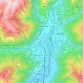
Name: Domodossola topographic map, elevation, terrain.
Location: Domodossola, Verbano-Cusio-Ossola, Piedmont, 28845, Italy (46.08309 8.19629 46.17899 8.30683)
Average elevation: 2,746 ft
Minimum elevation: 768 ft
Maximum elevation: 7,881 ft
Thank you for supporting this site ❤️
Make a donation
Make a donation
Gear up for your next adventure:
As an Amazon Associate, this site earns from qualifying purchases at no extra cost to you.